Catching up to the technology available in the trucking space nowadays has never been easier and more available. Whether you’re looking to improve efficiency, reduce your operations costs, or need to fix your CSA scores, you can find an affordable tech solution that can help you manage your fleet.
This is no different with Geofencing.
In this guide, we’ll explain what is geofencing, how it works, how it compares to related technologies, and why it matters for modern fleet owners.
What Is Geofencing?
Definition and Basic Concepts
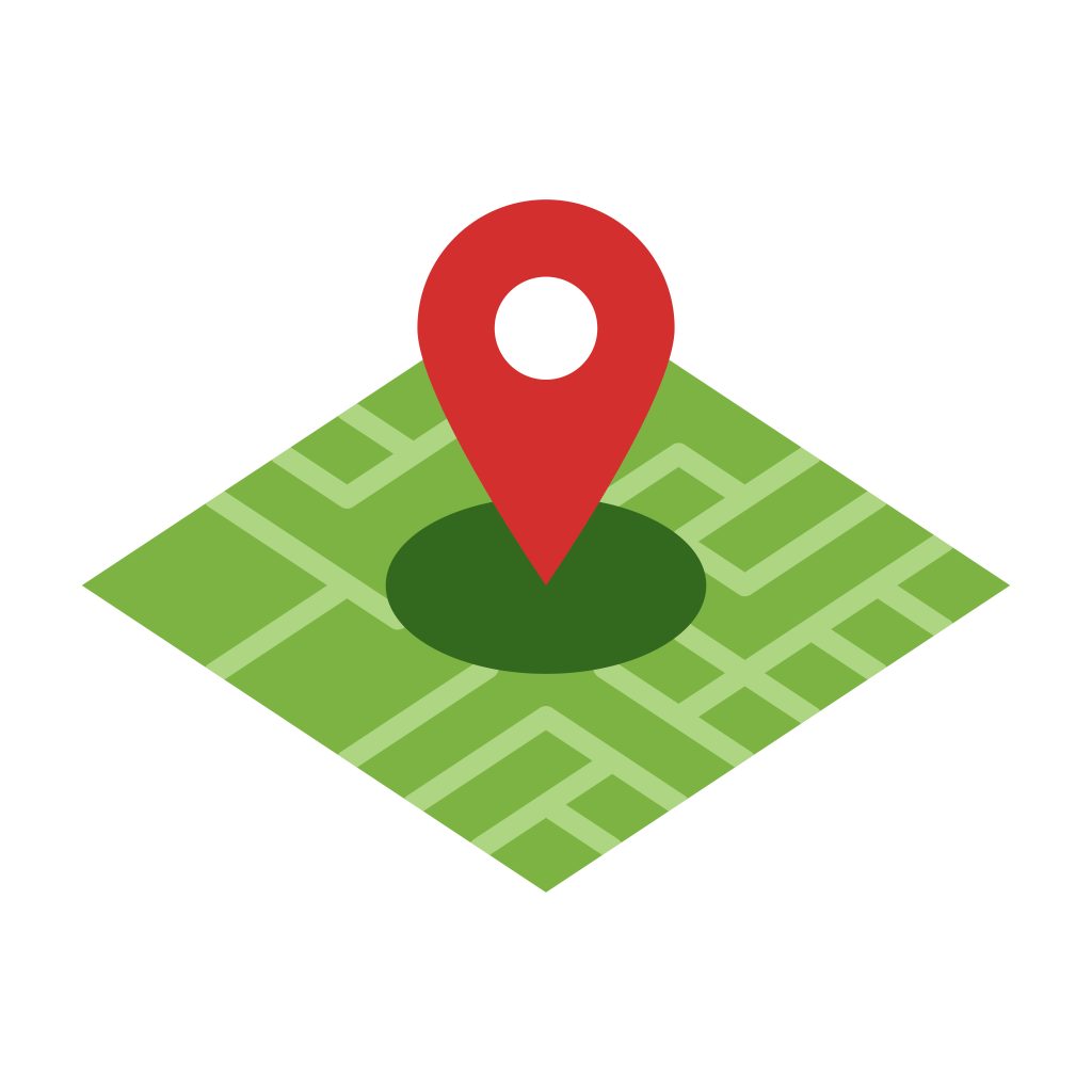
Simply put, geofencing is a location-based technology that creates virtual boundaries around a specific geographic area. When a vehicle, mobile device, or tracked asset enters or exits that predefined area, the system automatically triggers an action or notification.
Businesses can create these boundaries around warehouses, customer locations, job sites, restricted areas, or service zones.
The geofencing meaning in fleet operations goes beyond simply viewing a map. It allows companies to automate monitoring, improve accountability, and receive updates without constantly checking vehicle locations manually.
For example, a delivery company may create a geofence around a customer site. When a driver arrives, the system can automatically log the arrival time and send push notifications to dispatchers or customers.
Today, geofencing is widely used across industries including transportation, construction, logistics, utilities, field services, and public transportation.
Key Components of Geofencing Technology
Several elements work together to make geofencing technology effective:
- GPS trackers installed in vehicles or equipment
- GPS technology used to determine precise location
- Mapping software that defines geofence zones
- Cellular data networks that transmit information
- Cloud-based dashboards for monitoring and reporting
- Automated alerts and notifications
Most modern systems rely on continuous location tracking to monitor the movement of vehicles and assets. Once a tracked object crosses a geofence boundary, the system records the activity instantly.
Advanced geofencing software can also integrate with dispatching, routing, maintenance tracking, payroll systems, and customer communication platforms.
Geofencing vs. Related Technologies
Many people confuse geofencing with other tracking or marketing technologies. While these systems may overlap in some ways, they serve different purposes.
Differences Between Geofencing and GPS
One of the most common misconceptions is that geofencing and GPS are the same thing.
GPS is the underlying positioning system that determines where a vehicle or asset is located. Geofencing uses GPS data to create rules and automated actions around defined areas.
Think of GPS as the technology that provides location data, while geofencing adds automation and intelligence to that information.
For example:
- GPS can show where a truck currently is.
- Geofencing can automatically notify managers when that truck enters a warehouse zone.
Without GPS trackers, geofencing vehicle tracking would not function properly.
Differences Between Geofencing and Geotargeting
Geofencing and geotargeting are also commonly confused.
Geotargeting is typically used in advertising and marketing. Businesses use it to deliver ads or promotional content to users based on their location.
Geofencing, on the other hand, focuses more on monitoring, automation, operations, and security.
For fleet businesses, geofencing helps manage vehicles, optimize workflows, and improve operational oversight instead of targeting customers with ads.
Differences Between Geofencing and Beacons
Beacons are small Bluetooth-enabled devices used for close-range communication.
Unlike geofencing, which can cover large geographic areas, beacons operate within limited indoor ranges such as retail stores or office buildings.
Geofencing in cars is much more suitable for fleet management because it works across cities, states, and entire delivery routes.
How does Geofencing Work
Many fleet owners ask, how does geofencing work in practical terms?
The process starts when a company creates a virtual geographic boundary using mapping software. These active geofences can be circular, rectangular, or custom-shaped depending on operational needs.
Once the geofence is created, the tracking system continuously monitors the vehicle’s position through GPS trackers and location tracking tools.
When a vehicle enters or exits the designated zone, the system automatically performs a predefined action, such as:
- Sending a text message to a fleet manager
- Triggering push notifications to customers
- Recording arrival and departure times
- Updating dispatch systems
- Logging compliance records
- Alerting managers of unauthorized movement
What Are Geofence Alerts?
These are automated notifications triggered whenever a vehicle or asset crosses a geofence boundary.
A common question businesses ask is, what is a geofence alert and why is it important? The answer lies in automation and visibility. Instead of constantly watching a tracking dashboard, managers receive instant updates when important events occur.
Geofence alerts can be delivered through:
- Mobile apps
- Push notifications
- Dashboard alerts
- SMS messages
Common Types of Geofence Alerts
Fleet businesses can configure many different types of alerts depending on operational goals.
Common geofence alerts include:
- Vehicle arrival alerts
- Vehicle departure alerts
- Unauthorized after-hours movement
- Idle time notifications
- Speeding alerts
- Route deviation alerts
- Maintenance yard entry alerts
- Restricted zone violations
For example, a construction company may create geofences around job sites to ensure equipment remains within approved areas.
Similarly, delivery fleets can use alerts to automatically notify customers when drivers are approaching a delivery destination.
The Role of Geofencing in Fleet Management
Geofencing plays a major role in improving fleet management operations across nearly every industry.
Fleet operators need accurate, automated systems that help reduce manual work while improving oversight. Geofencing provides that automation by turning raw location data into actionable information.
With properly configured geofencing technology, businesses can:
- Track arrivals and departures automatically
- Improve dispatch efficiency
- Monitor unauthorized vehicle usage
- Reduce paperwork and manual check-ins
- Improve driver accountability
- Enhance route management
- Increase asset visibility
Geofencing also supports asset tracking for trailers, heavy equipment, and mobile machinery.
How Geofencing is used in vehicles
There are many practical applications for geofencing in transportation and logistics.
Some common uses include:
Delivery Monitoring
Dispatchers can track when drivers arrive at customer locations and verify delivery timelines automatically.
Theft Prevention
Businesses can create geofences around secure yards or operating regions. If a vehicle leaves an approved area after hours, managers receive immediate alerts.
Driver Behavior Oversight
Fleet managers can monitor unauthorized stops, excessive idle times, or route deviations that may indicate inefficient driver behavior.
Automated Time Tracking
Some companies use geofencing to automate driver clock-ins and clock-outs based on vehicle location.
Compliance Reporting
Arrival times, departure logs, and route histories can all be documented automatically for compliance and auditing purposes.
Benefits of Geofencing for Your Fleet
The benefits of geofencing extend far beyond basic tracking. When implemented correctly, geofencing can improve nearly every aspect of fleet operations.
Real-time visibility
One of the biggest advantages of geofencing is real-time visibility.
Fleet managers always know where vehicles are located and when they enter or exit important areas. This visibility helps businesses make faster decisions and respond quickly to unexpected issues.
Improved location tracking also helps dispatchers provide more accurate delivery updates to customers.
Improved security
Vehicle theft and unauthorized use remain major concerns for fleet businesses.
Geofencing improves security by immediately alerting managers if vehicles leave approved areas or operate during unauthorized hours.
Companies can also establish restricted zones around high-risk areas or sensitive job sites.
Combined with vehicle tracking systems, geofencing becomes a powerful theft prevention tool.
Operational efficiency
Manual tracking processes waste time and increase the risk of errors.
By automating arrival logs, route monitoring, and dispatch notifications, geofencing streamlines operations significantly.
Managers no longer need to manually confirm whether drivers reached a location because the system handles the process automatically.
These efficiencies become especially valuable for fleets managing dozens or hundreds of vehicles.
Reduced fuel costs
Fuel is one of the largest expenses for most fleets.
Geofencing helps reduce fuel costs by improving route management, reducing unnecessary idle time, and identifying inefficient routes.
Managers can also detect unauthorized vehicle usage that may contribute to excess fuel consumption.
With better operational oversight, businesses can improve route planning and minimize wasted mileage.
Better customer service
Customers expect accurate delivery windows and timely updates.
Geofencing allows businesses to send automated notifications when drivers are approaching a location or have completed a service call.
This improves communication and creates a more professional customer experience.
Businesses can also provide more accurate ETAs because dispatchers have better visibility into fleet movements.
Compliance & accountability
Compliance reporting becomes easier when geofencing systems automatically record important operational data.
Arrival times, departure times, route histories, and stop durations can all be stored automatically.
This information helps businesses improve accountability while simplifying audits and reporting.
The benefits of geofencing also include reduced paperwork and fewer disputes related to deliveries or service completion times.
How to Set Up Geofencing for Your Fleet
Setting up a geofencing solution for your fleet is typically a straightforward process.
Step 1: Install Tracking Devices
The first step is equipping vehicles with compatible GPS trackers.
These devices collect location information and transmit it back to the tracking platform.
Step 2: Choose Important Locations
Identify the locations where monitoring is most valuable.
Common examples include:
- Warehouses
- Customer locations
- Job sites
- Distribution centers
- Restricted areas
- Fuel stations
- Maintenance facilities
Step 3: Create Geofence Zones
Using geofencing software, create digital boundaries around each selected location.
Businesses can customize zone sizes and shapes depending on operational needs.
Step 4: Configure Alerts
Set up automated notifications for specific events.
For example, managers may want alerts for:
- Vehicle arrivals
- Unauthorized movement
- Long idle times
- Route deviations
- Late departures
Step 5: Train Your Team
Drivers and dispatchers should understand how the system works and how the data will be used.
Proper training helps maximize efficiency while reducing confusion or resistance.
Step 6: Monitor and Optimize
Once the system is active, review reports regularly and adjust geofence settings as needed.
Operational needs may change over time, so ongoing optimization is important.
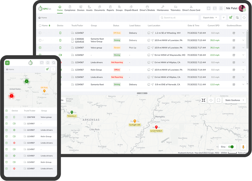
Why Choose GPSTab as Your Geofencing Provider?
Choosing the right provider is critical when implementing geofencing technology.
GPSTab offers advanced tracking tools designed specifically for modern fleet operations. With powerful reporting features, customizable alerts, and intuitive dashboards, businesses can gain greater visibility into their operations without unnecessary complexity.
GPSTab provides:
- Real-time fleet monitoring
- Easy-to-configure geofence zones
- Automated notifications
- Detailed reporting
- Route optimization tools
- Driver monitoring features
- Scalable solutions for growing fleets
Whether you manage a small local fleet or a nationwide operation, GPSTab helps simplify tracking, improve efficiency, and strengthen operational control.
As fleet operations become more complex, businesses need smarter tools to stay competitive. Geofencing provides fleet owners with a powerful way to improve visibility, automate workflows, enhance security, and reduce operational costs.
By combining GPS technology, automation, and real-time monitoring, geofencing helps businesses operate more efficiently while delivering better service to customers.
From improving security to optimizing routes and increasing accountability, the value of geofencing continues to grow across the transportation industry.
For companies looking to modernize operations and gain more control over their fleets, implementing a reliable geofencing system is a smart investment.
FAQs
What is the purpose of geofencing?
Geofencing is used to monitor vehicles, assets, or mobile devices within predefined geographic areas. Businesses use it to automate alerts, improve security, optimize operations, and enhance visibility.
Is geofencing safe and legal?
Yes, geofencing is generally safe and legal when used responsibly and in compliance with privacy laws. Fleet companies should clearly communicate tracking policies to drivers and ensure collected data is handled securely.
How does a geofence work?
A geofence works by creating a digital boundary around a geographic location. When a tracked vehicle enters or exits that area, the system automatically triggers notifications or other predefined actions.
How accurate is geofencing?
The accuracy of geofencing depends on several factors, including GPS signal quality, internet connectivity, and device hardware. Most modern systems provide highly accurate monitoring within a few meters under normal conditions.